25 September 2026, 09:51
Loading...
Geographic information system at NET4GAS: A digital pillar of gas infrastructure and the energy transition

Lukáš Lepič
4 December 2025, 13:16
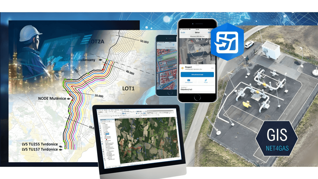
Gas infrastructure is often invisible at first glance – pipes hidden underground, kilometres of pipelines, thousands of pieces of equipment and facilities. Yet it is one of the most important systems underpinning the Czech Republic’s energy security. To ensure everything operates accurately, safely and without interruption, NET4GAS, the gas transmission system operator, needs not only reliable field technology, but also a perfect overview of where every element is located, what condition it is in and how the individual parts are interconnected.
This digital tool for the gas system is the Geographic Information System (GIS) – a tool that has become a key pillar at NET4GAS for modern system management, spatial analysis, safety management and the preparation of projects such as converting gas pipelines to hydrogen transport or potential future CO₂ infrastructure.
GIS connects vast amounts of data, field technology, analytical systems and people across the organisation – enabling one of the country’s most vital energy networks to be operated with high precision, efficiency and a vision for the future.
GIS as a central platform for infrastructure management
The Geographic Information System at NET4GAS provides the digital foundation for recording, managing and analysing the entire gas infrastructure. It is not just software – it is a central platform that combines geographic data with key enterprise systems, such as PIMS (Pipeline Integrity Management System), SAP PM, V3S (the system for issuing technical infrastructure owner statements), DIP (Investment Project Documentation) and DMS. Thanks to this level of integration, GIS becomes a tool that supports operational decision-making, enhances safety and significantly facilitates infrastructure development planning. It makes it possible to quickly link the technical condition of equipment with its precise location and the wider territorial context, which is crucial, for example, during repairs, emergencies or investment preparation.
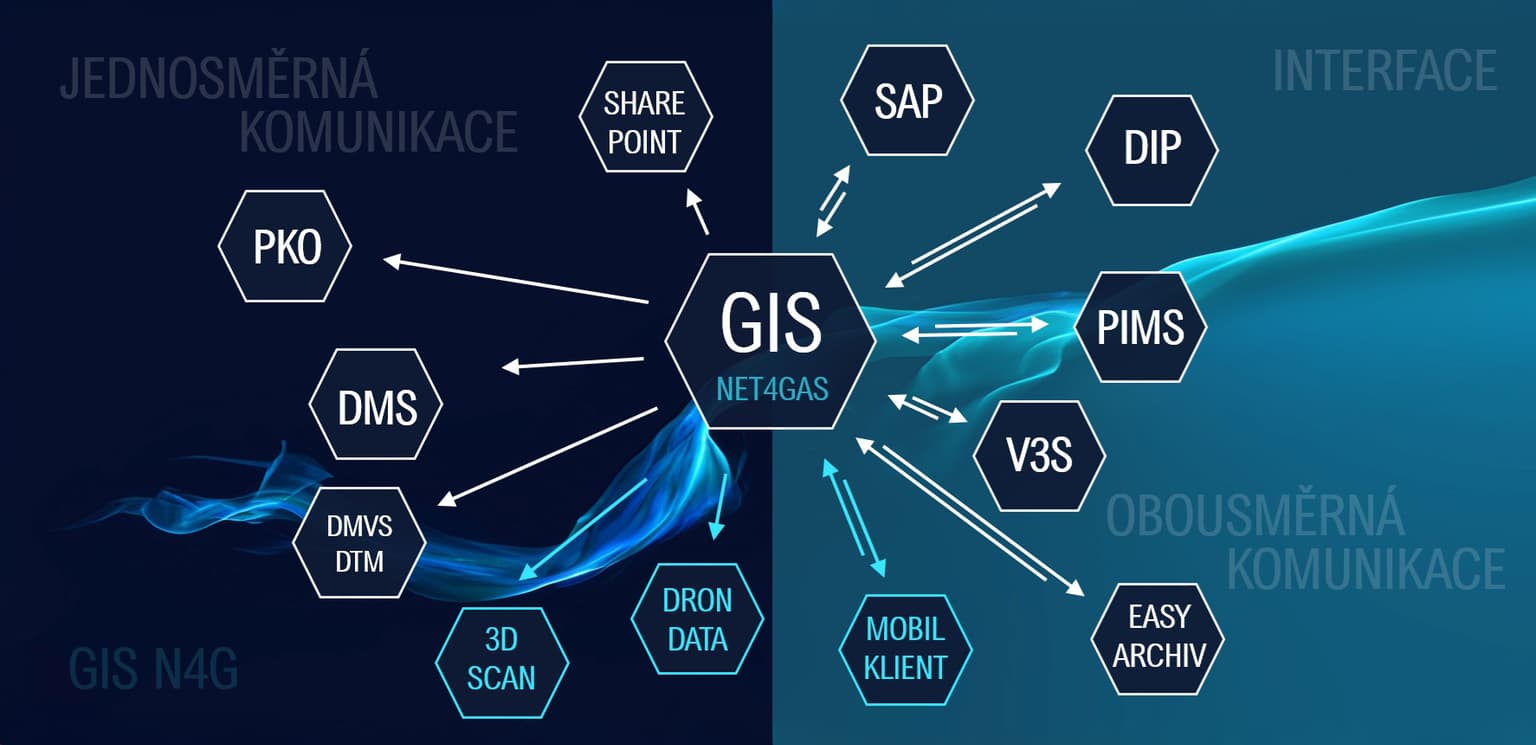
GIS interface. Source: NET4GAS
Data model and data: A digital model of the gas transmission system
The basis of a functioning GIS is a robust data model. At NET4GAS, it precisely defines which data are recorded, how they are stored and how they relate to one another. GIS therefore contains a complete digital representation – a digital model – of the entire transmission system. This makes it possible to understand the infrastructure not merely as pipelines, but as an interconnected system of thousands of elements whose technical and spatial characteristics are interrelated.
It consists primarily of two groups of data:
- Surveying data – precisely surveyed routes of gas pipelines, technological facilities, cables, corrosion protection elements and electrical connections. These are data on exactly where individual elements are located and how they are situated in the field.
- Technological 2D diagrams of individual facilities – a logical representation of the relationships between elements within pipeline stations and other installations. They do not show their position in the field, but indicate how the system within the facility operates and how its elements are interconnected.
In short, NET4GAS GIS stores a complete spatial, technical and documentary representation of the entire infrastructure. This allows staff to quickly understand the context and better assess the impact of any change.
Thanks to its connection to the digital archive, both archived and current documentation can be displayed easily. In practice, this means faster orientation in the field, more efficient repairs and greater operational safety – for example, in a situation where the parameters of a specific valve or associated infrastructure need to be verified immediately.
Mobile data collection: When a technician is standing right by the pipeline
High-quality data are created primarily in the field – where the infrastructure is actually located. NET4GAS mobile staff therefore use satellite receivers with centimetre-level accuracy and work with tablets or smartphones equipped with a mobile GIS client. Precise measurements and direct data entry on site significantly reduce the risk of errors and the time required to process them.
Imagine a technician standing by a section of pipeline, carrying out an inspection and updating the data in real time. Once the data are saved, they immediately appear in GIS and are available to designers and other teams. The digital infrastructure model is thus updated virtually continuously.
This approach offers several key benefits:
- data are always accurate and up to date,
- response is much faster in emergency situations,
- information is immediately shared across teams,
- technology effectively complements the experience of field staff.
Mobile GIS thus connects the physical world of infrastructure with its digital representation, enabling more accurate and faster decision-making.
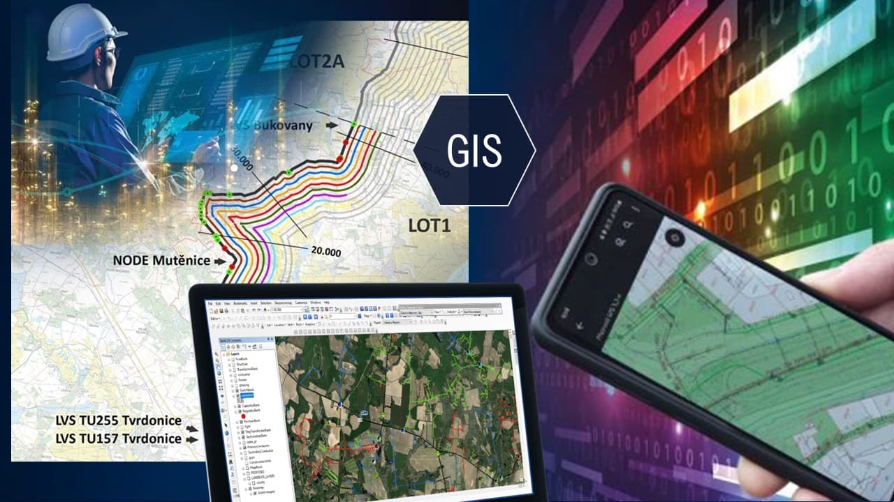
Data display in GIS. Source: NET4GAS
Map applications and external sources: Information where it is needed
GIS specialists process, validate and update spatial data, which are then made available to employees through a modern map portal – accessible both on computers and mobile devices. This gives maintenance staff, designers and dispatchers access to the same information, albeit in different contexts.
Map applications are designed modularly, according to the needs of individual departments. An application for gas quality measurement therefore looks different from one for managing telecommunications infrastructure or monitoring aircraft overflights above gas pipelines. Users can monitor planned construction projects, quickly search for a facility, verify technical parameters or coordinate fieldwork. This significantly simplifies communication and reduces the risk of misunderstandings.
In addition to internal data, NET4GAS also uses external geospatial and geodata services that provide information on the plans of other entities, nature protection, geological conditions and flood zones. A single map environment can therefore quickly show where new construction is planned, whether an area is protected or what restrictions apply to a particular location. In practice, this means, for example, that the system provides an early warning of a potential conflict between a construction plan and a gas pipeline safety zone – even before work begins in the field.
Technology innovation: Drones and 3D scans are changing how we see infrastructure
NET4GAS is gradually expanding its GIS with modern technologies that are fundamentally changing how infrastructure can be documented and analysed. What previously required demanding surveying measurements can now be completed within minutes using photogrammetry or laser scanning.
Drone imaging makes it possible to capture detailed image data of technological facilities, which can then be converted into precise 3D models. These models serve as visually faithful documentation that can be used for maintenance, technical planning or design work. They improve occupational safety because staff do not need to enter hazardous locations, while also speeding up the entire data collection process.
Similarly, 3D laser scanning can capture structural details with millimetre accuracy. The resulting digital models assist in contractor inspections, reconstruction planning and the preparation of investment projects. They minimise the risk of clashes, improve the accuracy of project documentation and make it possible to simulate future interventions in space.
For NET4GAS, this represents a major step forward – faster work, greater safety, more accurate data and the ability to create realistic 3D digital models of technological facilities.
Strategic projects: Hydrogen, European corridors and CO₂ infrastructure
The energy landscape is changing dynamically, and GIS is a key tool in preparing projects that will shape the future of Czech energy.
H2Readiness – preparing the network for hydrogenGIS makes it possible to assess which parts of the infrastructure can be adapted for the transport of clean hydrogen, evaluate technical and operational parameters, and identify territorial or environmental constraints. It provides project teams with the precise data and analyses needed to plan the transformation.
European hydrogen corridors SEEHyC (South-East European Hydrogen Corridor) and CEHC (Central European Hydrogen Corridor)These projects are intended to connect the Czech Republic to the European hydrogen network. GIS assists with spatial analyses, route planning, landscape impact assessments and ensuring compliance with legislation and land-use plans. This makes it possible to design routes that will be technically feasible, safe and compatible with European infrastructure.
CCS and CO₂ infrastructureIn the area of potential future CO₂ transport, GIS could enable analysis of options for using existing gas pipelines, the design of new routes, assessment of environmental constraints and modelling of territorial impacts.
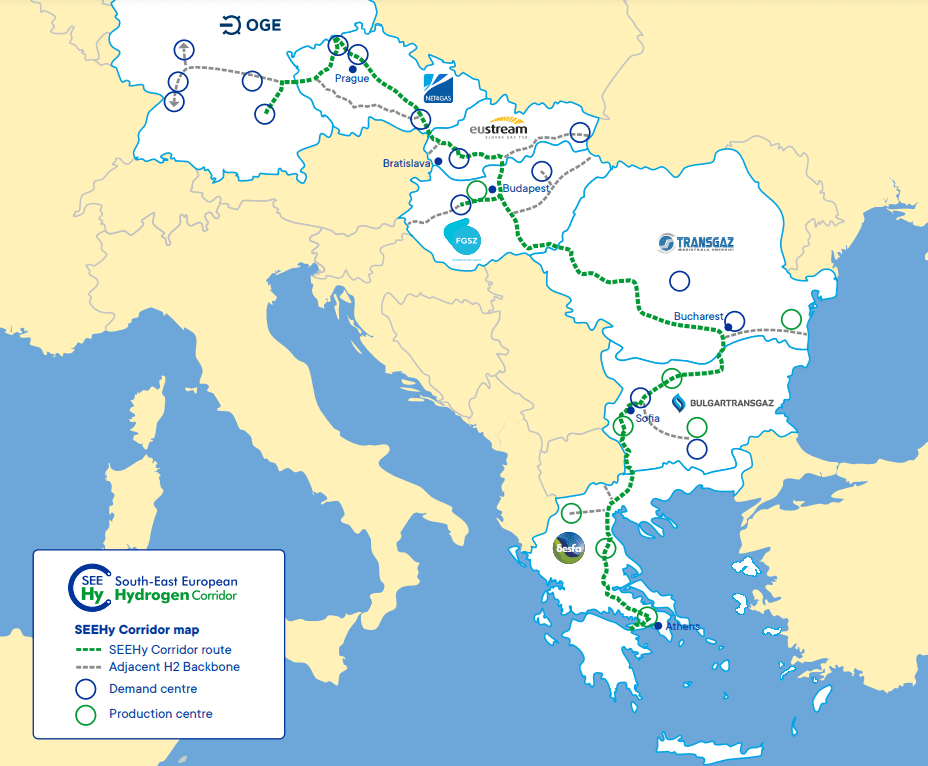
South-East European Hydrogen Corridor. Source: NET4GAS
Translation disclaimer
This article is a machine translation of the Czech original and has not yet been fully reviewed. In case of any doubt, please refer to the Czech version.
Sdílejte článek prostřednictvím:
You might also like

24 September 2026, 11:23

24 September 2026, 10:30
24 September 2026, 06:56